Faidhle:Cornwall UK locator map 2010.svg

Size of this PNG preview of this SVG file: 494 × 600 piogsail. Dùmhlachdan-breacaidh eile: 198 × 240 piogsail | 395 × 480 piogsail | 633 × 768 piogsail | 843 × 1,024 piogsail | 1,687 × 2,048 piogsail | 1,108 × 1,345 piogsail.
Am faidhle tùsail (Faidhle SVG, a-rèir ainm 1,108 × 1,345 pixel, meud faidhle: 302 KB)
Gearr-chunntas
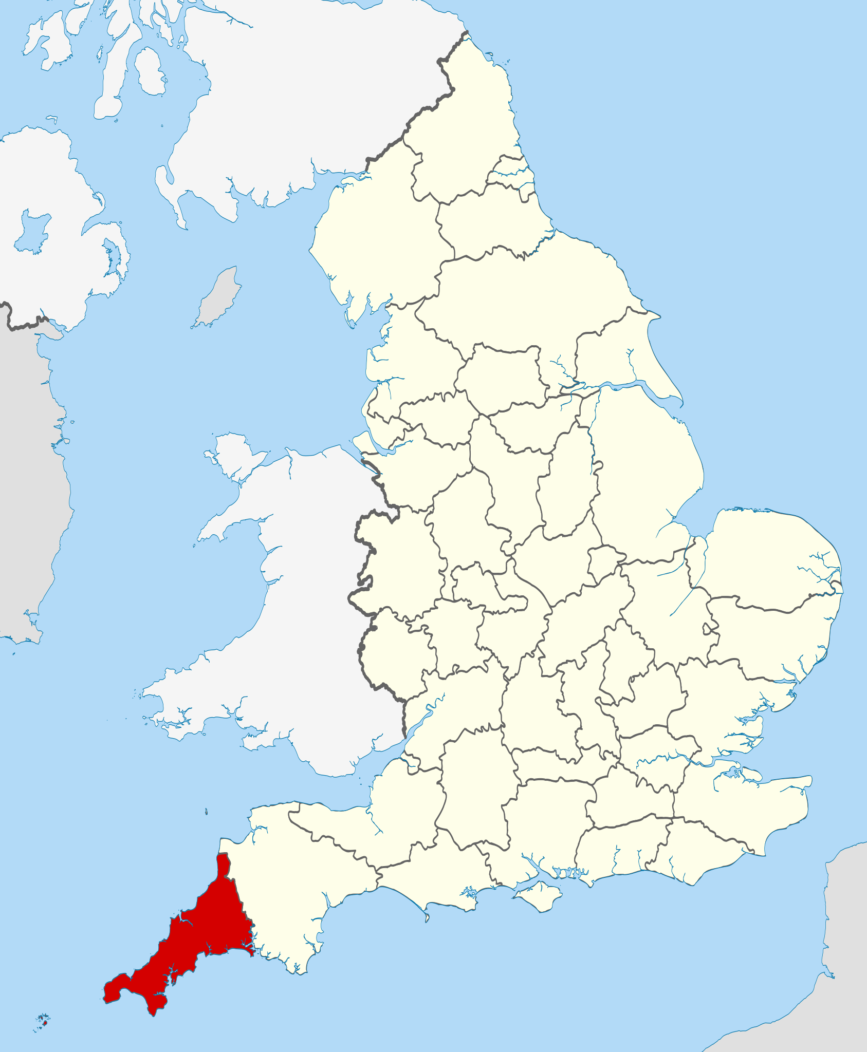
| Tuairisgeul | Location of Cornwall. |
| Ceann-là | |
| Tùs |
National Geospatial-Intelligence Agency
|
| Ùghdar | Nilfanion |
Ceadachadh
I, the copyright holder of this work, hereby publish it under the following licenses:
Tha am faidhle seo fo cheadachas Creative Commons Attribution-Share Alike 3.0 Unported.
- Faodaidh tu:
- a cho-roinneadh – lethbhreac a dhèanamh dhen obair, a sgaoileadh is a tar-chur
- ath-mheasgachadh – an obair atharrachadh
- Fo bhuaidh nan cumhaichean a leanas:
- urram – Feumaidh tu iomradh a thoirt air an ùghdar no an neach aig a bheil cead air, dìreach mar a thoill iad (ach chan ann air dòigh a chuireas an sùilean dhaoine gu bheil iad ag aontachadh riut no ri d’ obair).
- co-roinneadh co-ionnann – Ma dh’atharraicheas tu no ma leasaicheas tu an obair seo, ’s urrainn an tionndadh ùr fon cheadachas seo no fo cheadachas coltach ris.

|
Permission is granted to copy, distribute and/or modify this document under the terms of the GNU Free Documentation License, Version 1.2 or any later version published by the Free Software Foundation; with no Invariant Sections, no Front-Cover Texts, and no Back-Cover Texts. A copy of the license is included in the section entitled GNU Free Documentation License. |
’S urrainn dhut an ceadachas as fhearr leat a thaghadh.

|
This is one of the images forming part of the Valued image set: Locator maps of the Ceremonial counties of England on Wikimedia Commons. The image set has been assessed under the valued image set criteria and is considered the most valued set on Commons within the scope:
Locator maps of the Ceremonial counties of England
You can see its nomination at Commons:Valued image candidates/Locator maps of English ceremonial counties. |
Eachdraidh an fhaidhle
Briog air ceann-là/àm gus am faidhle a shealltainn mar a nochd e aig an àm sin.
| Ceann-là/Àm | Dealbhag | Meud | Cleachdaiche | Beachd | |
|---|---|---|---|---|---|
| làithreach | 22:27, 23 dhen t-Samhain 2010 | | 1,108 × 1,345 (302 KB) | Nilfanion | various tweaks |
| 20:44, 26 dhen Dàmhair 2010 |  | 817 × 990 (1.33 MB) | Nilfanion | {{Information |Description=Location of Cornwall within England, with the ceremonial counties shown. |Source=Ordnance Survey [https://www.ordnancesurvey.co.uk/opendatadownload/products.html OpenData]: *County boundaries |
Cleachdadh an fhaidhle
Tha ceangal ris an fhaidhle seo san duilleag a leanas:
Cleachdadh fhaidhlichean uile-choitcheann
Tha na uicidhean eile a leanas a’ cleachdadh an fhaidhle seo
- Cleachdadh air bg.wikipedia.org
- Cleachdadh air br.wikipedia.org
- Cleachdadh air ca.wikipedia.org
- Cleachdadh air ceb.wikipedia.org
- Cleachdadh air cs.wikipedia.org
- Cleachdadh air dag.wikipedia.org
- Cleachdadh air de.wikipedia.org
- Cleachdadh air en.wikipedia.org
- Cornwall
- Portal:Cornwall
- Grade I listed buildings in Cornwall
- Wikipedia talk:WikiProject UK geography/Archive 11
- List of active separatist movements in Europe
- Grade II* listed buildings in Cornwall (A–G)
- Grade II* listed buildings in Cornwall (Q–Z)
- Grade II* listed buildings in Cornwall
- Grade II* listed buildings in Cornwall (H–P)
- 1977 Cornwall County Council election
- 2005 Cornwall County Council election
- 1997 Cornwall County Council election
- 2001 Cornwall County Council election
- 1981 Cornwall County Council election
- 1985 Cornwall County Council election
- 1989 Cornwall County Council election
- Bossence (surname)
- Vingoe
- 1973 Cornwall County Council election
- 1993 Cornwall County Council election
- 1973 Kerrier District Council election
- Cleachdadh air en.wikiquote.org
- Cleachdadh air eo.wikipedia.org
- Cleachdadh air es.wikipedia.org
- Cleachdadh air fa.wikipedia.org
- Cleachdadh air fi.wikipedia.org
- Cleachdadh air fr.wikipedia.org
- Cleachdadh air fr.wiktionary.org
- Cleachdadh air hi.wikipedia.org
- Cleachdadh air hr.wikipedia.org
- Cleachdadh air hu.wikipedia.org
- Cleachdadh air io.wikipedia.org
- Cleachdadh air ja.wikipedia.org
Seall an corr dhen chleachdadh uile-choitcheann a nithear dhen fhaidhle seo.